Here's an example of how I pull together a number of the tools I've referenced in previous posts:
- I find a map that has information I want to display. For this example, I will use one of the Nelson Bible Atlas Maps that is free to incorporate into Logos entitled "Palestine in the Time of Jesus."
- Using my Faststone image capture program, I save an image copy of the map.
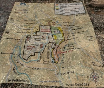
- I open GoogleEarth and use the Tools option to Add an Image Overlay. I locate the map file I just saved. It takes a bit of playing around, but it is quite easy to size the image to fit exactly over the GoogleEarth map of ancient Palestine. (Use the Transparency slider to check your work.)
- After saving that image overlay, it is now available in your "Places" bar in GoogleEarth. You can turn it on/off and adjust the transparency. You can still also work with the 3D terrain modeling and change your perspective, and the map will lay over the terrain.
- Here's an animated GIF (you may need to click on the map to see the animation) showing the work I've just described:

- As an another example that really shows off the features of this kind of tool, here is a map of Jerusalem in NT times, and if you play around with it GoogleEarth, it is very easy to see how the Kidron and Hinnon valleys meet and the Mount of Olives to the east.


No comments:
Post a Comment