
 |
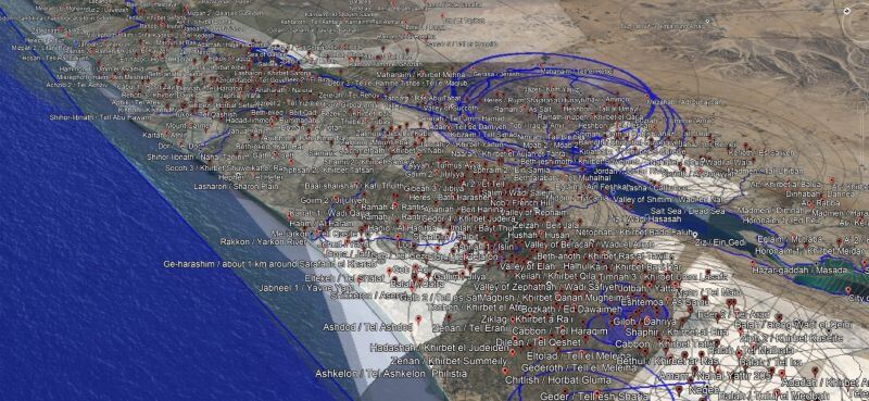
| An example of the KML file results which has about 7,100 placemarks in Google Earth. |
I have mention OpenBible.info before as an excellent resource for things like data visualizations and especially its Geocoding. Stephen Smith has recently updated his work and explained what he's been doing in this post: "Past as Probability: Rethinking the Bible Atlas for 2021." He writes:
What does rethinking the Bible Atlas mean?
This project is a Bible atlas (technically, a gazetteer) that (1) comprehensively identifies the possible modern locations of every place mentioned in the Bible as precisely as possible, (2) expresses a data-backed confidence level in each identification, and (3) links to open data to fit into a broader data ecosystem. The goal is to provide a baseline for future Bible geography projects to use.
In my original design document for this project, I have the following guiding principles; I’ll discuss their implementation below:
- Comprehensively reflect current scholarship.
- Use linked data.
- Be accurate and precise.
- Quantify uncertainty.
- Handle non-point data.
- Include media.
- Open the data.
It's a pretty stunning achievement considering the amount of work pulling the material together. His description of his work is worth reading, but if you just want to take advantage of his work, go to the Geocoding section. From there you can download the KML file for Google Earth with its 7100 Bible placemarks linked to the passages where a site is mentioned. You can also browse online by book and chapter of the Bible.
Thanks are due for sharing this resource so openly!


No comments:
Post a Comment